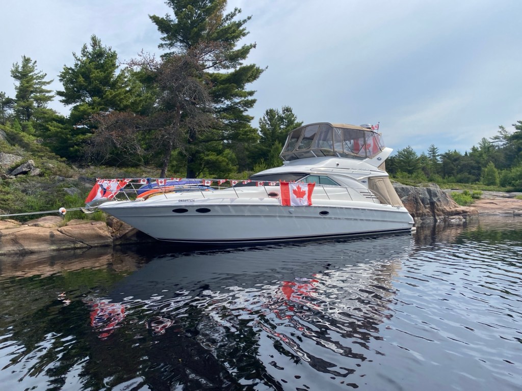
Off the Dock!
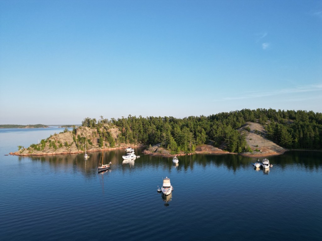
It’s a beautiful June day on southern Georgian Bay as we push off the dock and set course for our 2025 cruise. This is our first season on the water as a fully retired crew, and we’ve planned a six‑week route winding through Georgian Bay’s stunning 30,000 Islands and then on to the North Channel for wilderness anchorages and lively port calls.
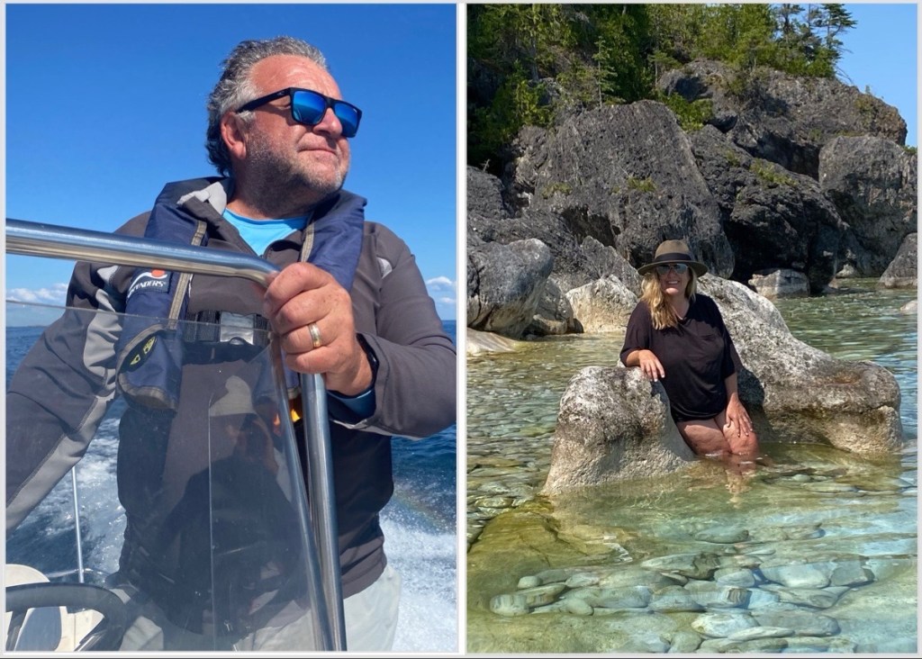
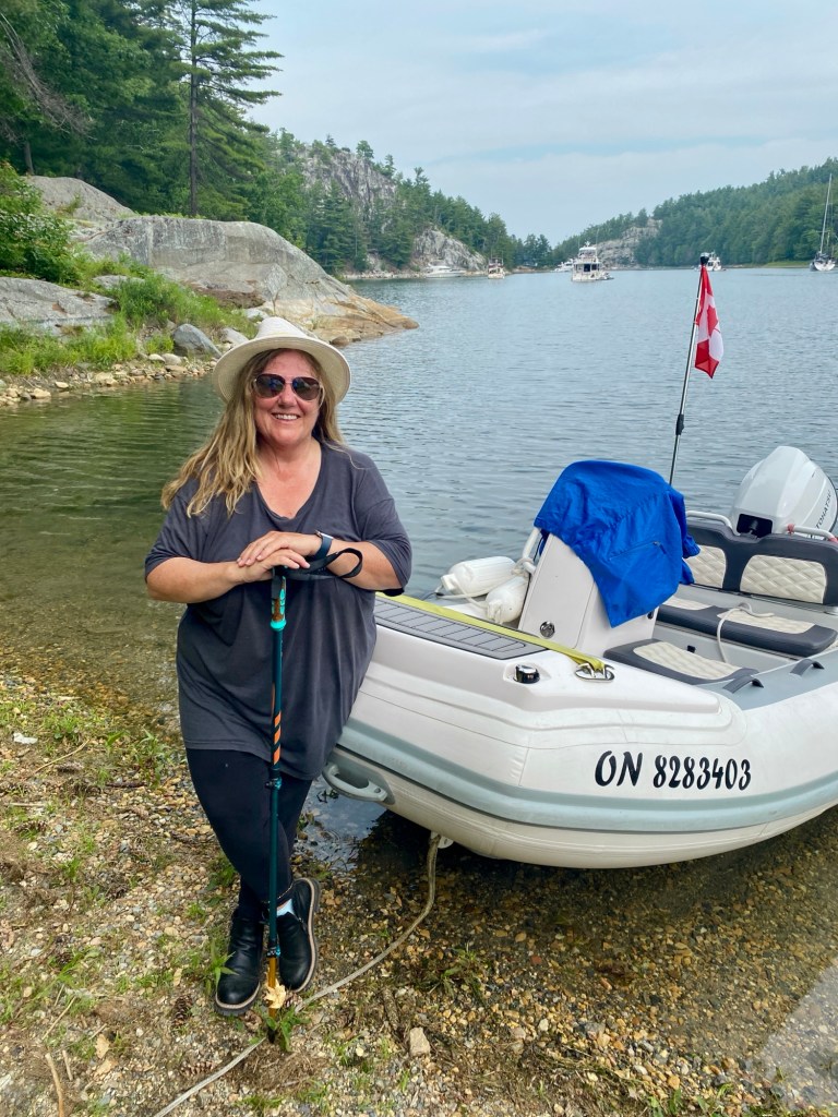
On board our 40’ Sea Ray sedan bridge “Georgian Pearl” is my husband (Captain Tony), myself (Admiral Elizabeth), our dinghy (George), and plenty of supplies. This is an especially exciting summer for us: our first post‑retirement cruise and at six weeks, our longest one yet.
Friends and Family
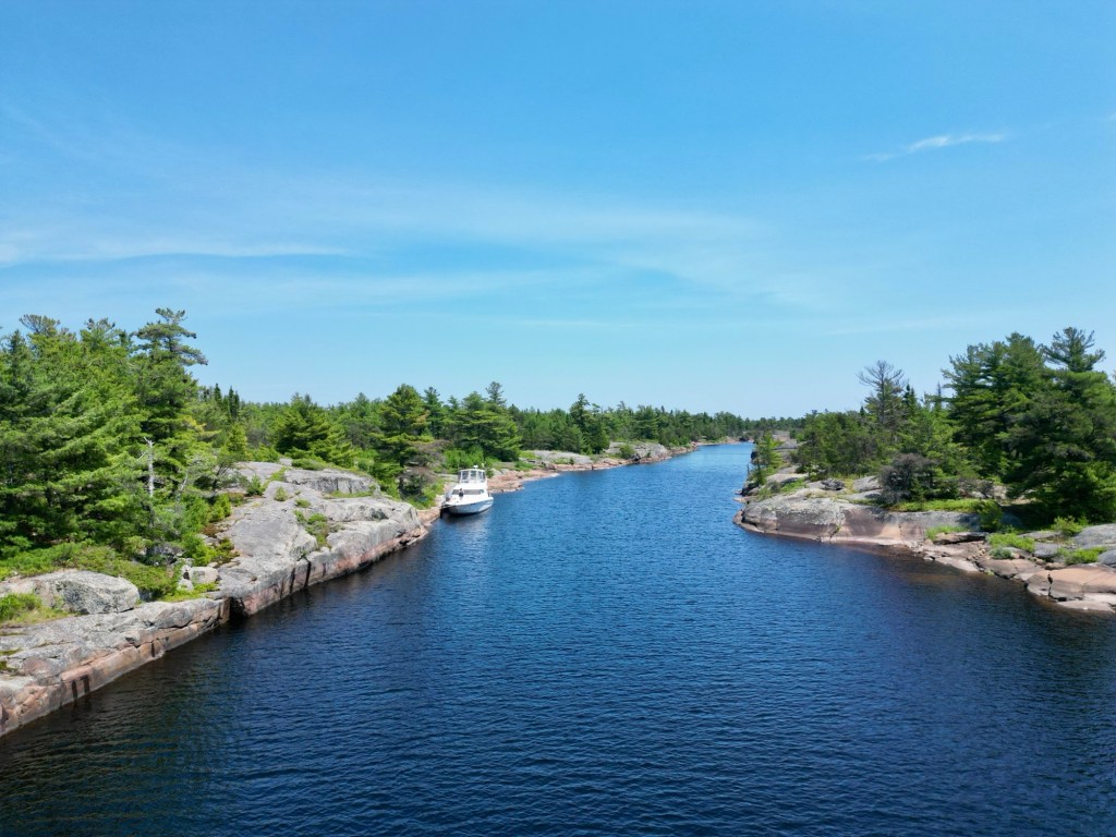
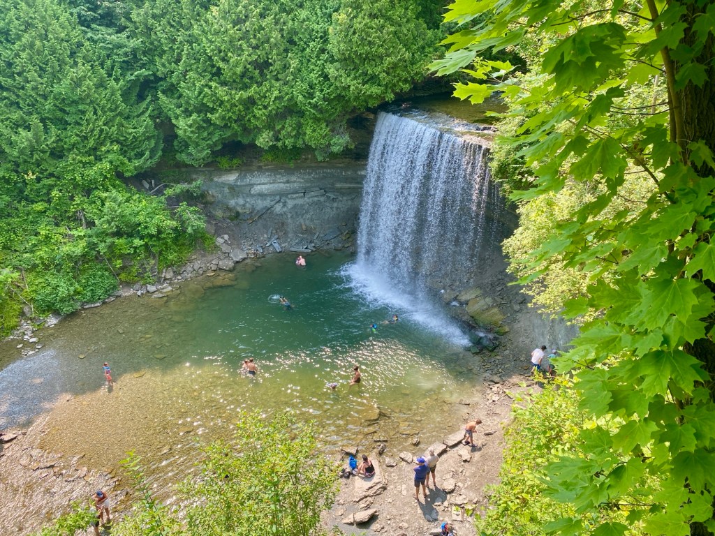
The thrill of departure quickly turns to joy at our first stop as we spend a few days reconnecting with family and boating friends in the Go Home area. Go Home, just 18 Nm north of Midland, recently celebrated its 125th year as an organized cottage community and has a few well protected anchorages but also many cottages along its shores. The best places to anchor if you wish to explore this area by dinghy are in nearby Indian Harbour or at American Camp Island.
Here are details about traveling through this area and exploring by dinghy, including how Go Home got its name!:
https://georgianbaybeauties.org/2022/06/11/the-falls-at-go-home/
After a fun few days, we depart Go Home early morning and continue our journey north. We are lucky with the weather today and breathe a sigh of relief as we depart the protection of Big David Bay and head towards the open water of O’Donnell point. It is here the small craft route winds through a fairly open area known for the nasty rollers that can build! Many Georgian Bay boaters have a horror story about O’Donnell point, it’s not a long distance but we try to avoid it when the lake is churning!
Once past O’Donnell we enter Twelve Mile and then Starvation Bay ensuring we make a securite over vhf well ahead as the passage is narrow and with no room for error. This is also a busy area in summer, with lots of cottage boat traffic. We soon pass through the Sans Souci area and reach the exit to the South Channel that will lead us into Parry Sound. Be sure to have a good look at your charts if it’s your first time here, there are a few different route options at this point and it can be confusing if you’re not familiar with the area.
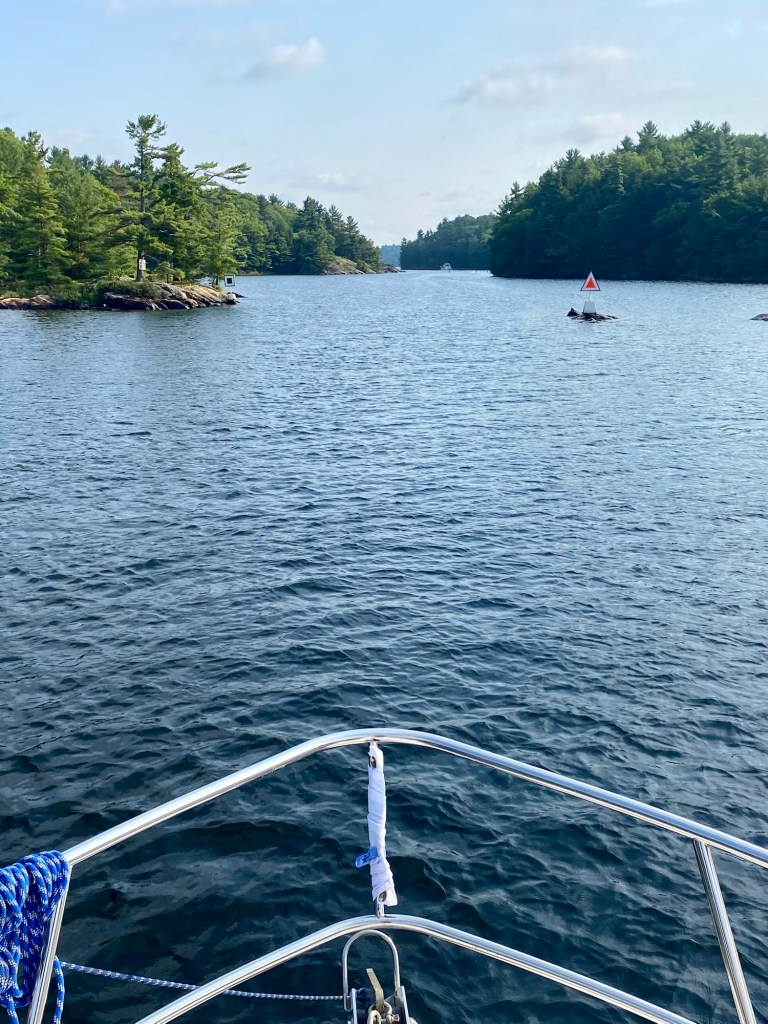
I love the South Channel for the scenery and interesting cottages that line it’s shores. However it is slow (mostly no wake zones) and gets a lot of boat traffic during summer months, including barges and the Island Queen tour boat, so always be monitoring channel 16 for reports of oncoming traffic. This is all part of summer on Georgian Bay!
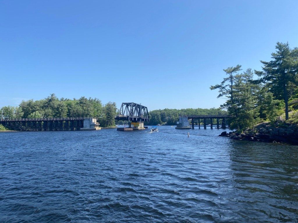
We soon reach the weathered timber swing bridge which joins Parry Island to the main land and today I have timed our speed perfectly so it’s a very short wait for the bridge to open. Occasionally the bridge may need to close for maintenance or high winds so always be sure to check their schedule before taking this route into Parry Sound – here is the link and note that the bridge operator monitors vhf channel 6:
https://www.sac-isc.gc.ca/eng/1604582527720/1604583507506
Urban Oasis
After the quiet of Go Home, entering the busy Parry Sound harbour feels like crossing into another world with all the activity happening in front of us – plane and boat traffic vie for water space, the old trestle bridge rumbles as another train passes through town blowing it’s whistle, the sound of music drifts over the water and we smell some good barbecue in the air causing our mouths to water – time to check into our slip and go exploring!
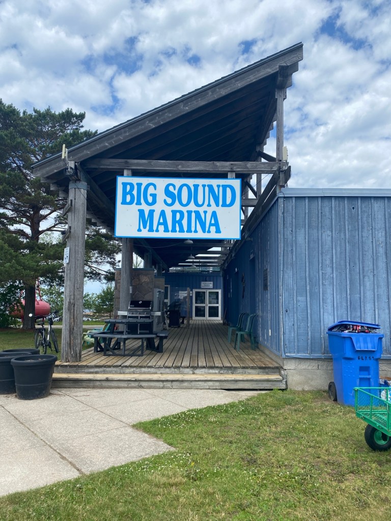
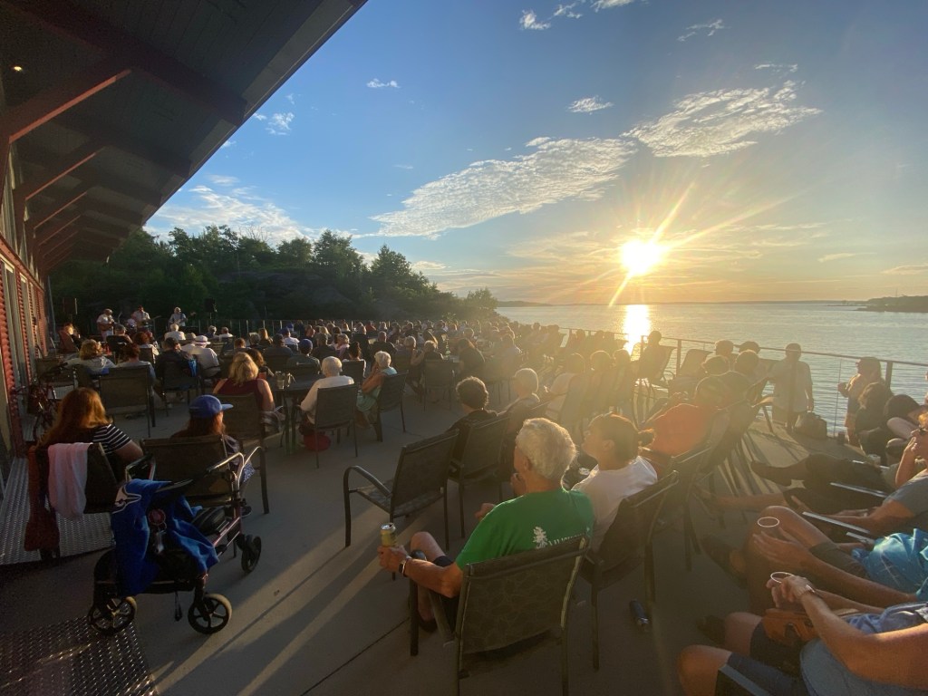
We always stay at Big Sound marina as we find it more private than the town dock but still an easy walk to town. And today is Tuesday which means the farmers market is happening in the main village square, the first place we visit to stock up on fresh local produce, breads, meats and honey! For dinner we grill a steak and then wander over to the Stockey Centre to check out “Bands on the Bay” – a free outdoor concert blending local talent with stunning sunsets over the Sound.
For more details on making the most of your Parry Sound visit, click link:
https://georgianbaybeauties.org/2022/09/14/weekend-getaway-to-parry-sound/
The next morning as we are preparing for departure the marine forecast indicates some very heavy thunderstorms will be coming our way within the next 24 – 48 hours. We had planned to enjoy an evening at Franklin Island after leaving Parry Sound but this new information has us rethinking our plans. Wanting to be in the north for July 1st we make the decision to travel offshore, put some miles behind us and go into Britt at Byng Inlet. We had been hoping our next stop would be an anchorage but our motto is safety over scenery.
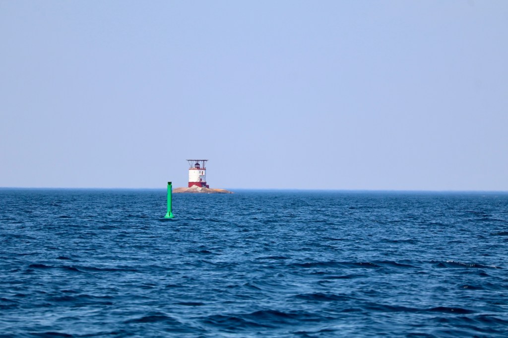
Departing Parry Sound we pass Franklin Island and the iconic Red Rock Light Tower, that faithful century-old guide for mariners transiting the Parry Sound area, also a federal historical structure due to its unique construction.
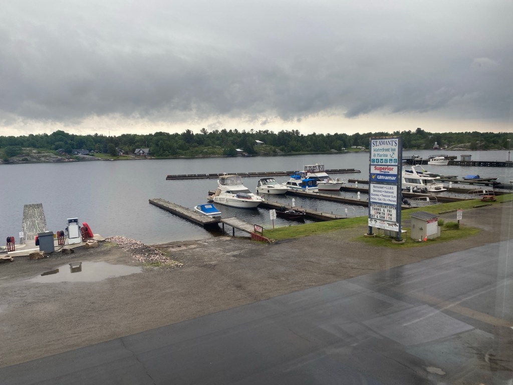
Four hours later we are gliding into St Amants at Britt on a sunny afternoon with no hint of the forecasted storms on the horizon however a small craft warning has been issued for tomorrow. We wonder if we should have continued on to our next destination – the Bad River – but decide to spend the night regardless and continue on in the morning if the forecast prediction proves incorrect.
Britt is a great place for boaters to escape from heavy seas or to get a refresh. Transient slips, fuel and pump outs, laundry/washroom/showers, grocery, liquor/wine sales and a restaurant. There is also much to explore – the Magnetewan and Still Rivers, the Gereaux Island Light House, and lots of good fishing. One note of caution: there once stood a large timber mill across the river and the many dead heads lurking just below the surface pay tribute to that history so always keep an eye out.
The next morning we awake to cloudy skies and a good breeze that continues to develop as the day progresses. The marine forecast is now predicting strong thunderstorms and squalls for later today and overnight so we make the decision to stay. Throughout the afternoon, a few other boats come in looking for a safe haven, they all struggle with docking in the strong west wind bearing down the channel.
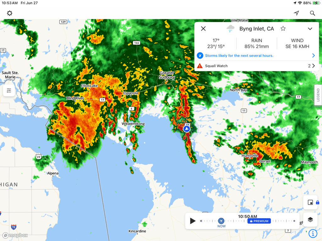
And it turns out we made a good decision as the storm that hits is one of the worst June storms the east coast of Georgian Bay has experienced in a while, with Parry Sound being one of the areas hardest hit. Britt wasn’t as bad but the strong west wind and current bearing down the channel made it feel like the docks were about to let go any minute!
The storm hangs around for another day but finally, after 3 nights at St Amants, we awake to sunshine and a light southeast wind. Exactly what we need for the Bad River. After fuel and pump out, we depart Britt and travel offshore making this a fairly quick run for us – within an hour of exiting the main channel and passing the Gereaux lighthouse, we are entering the Bad River where we plan to stay through Canada Day weekend.
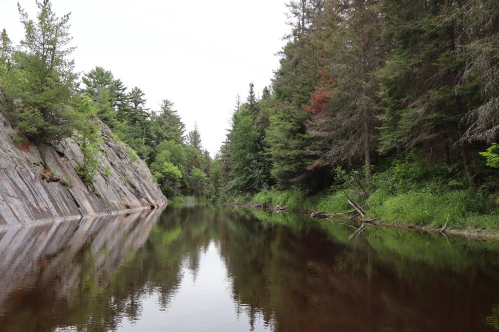
Wilderness Magic at the Bad
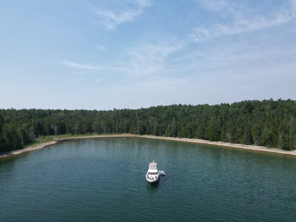
The Bad River is part of the French River delta and one of the best wilderness anchorage’s on Georgian Bay! This is where wild serenity reigns, white water churns and there are few words that capture the beauty of this remote paradise!
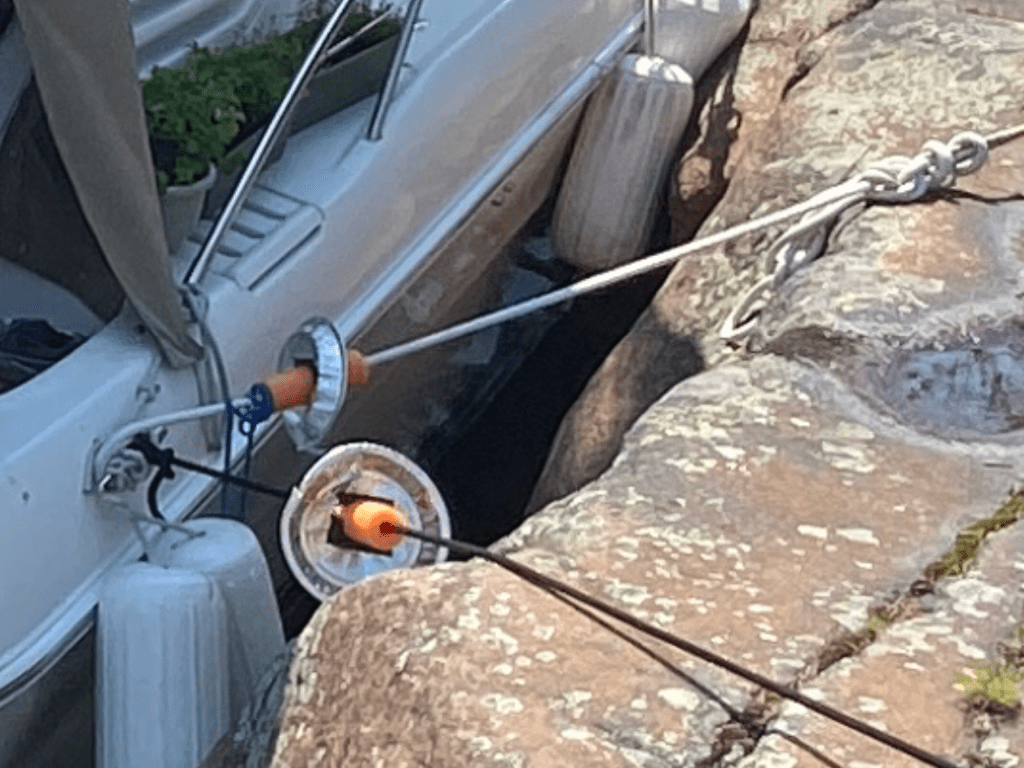
We tie up at “the wall” – an area along the eastern arm where the rock is sheer but at just the right height for shoreline tie-ups. We add cones to our lines to prevent wild mice and snakes from coming aboard (a necessity when tying to shore), we secure them in place with sliced pool noodles so they don’t slide when the lines flex. We waste no time releasing the dinghy and getting ready to go explore.
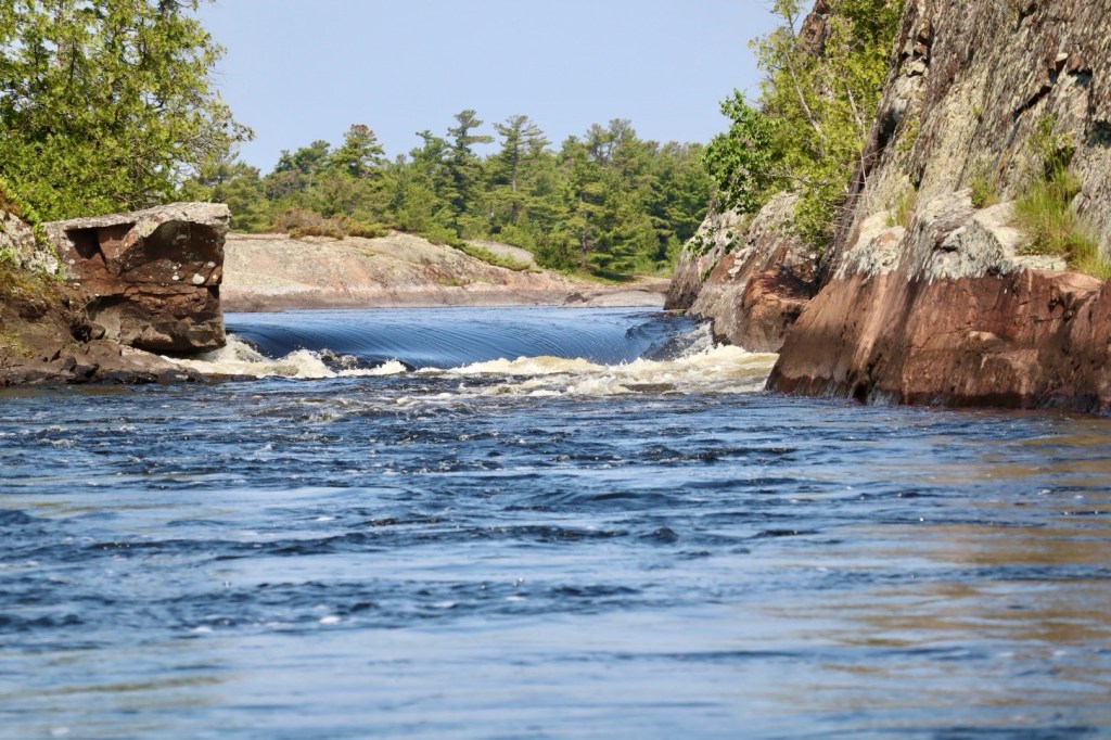
A big thrill when visiting the Bad is to dinghy through Devils Door, a narrow cut in the rock with strong rapids and a good drop – which looks to be about 3’ this year! The waters here are extremely dark due to the river run off so the many rocks that lurk just below the surface are incredibly hard to spot! For that reason we added a prop guard to our dinghy last year which has saved us countless times but we decide not to test it this year on Devils Door!
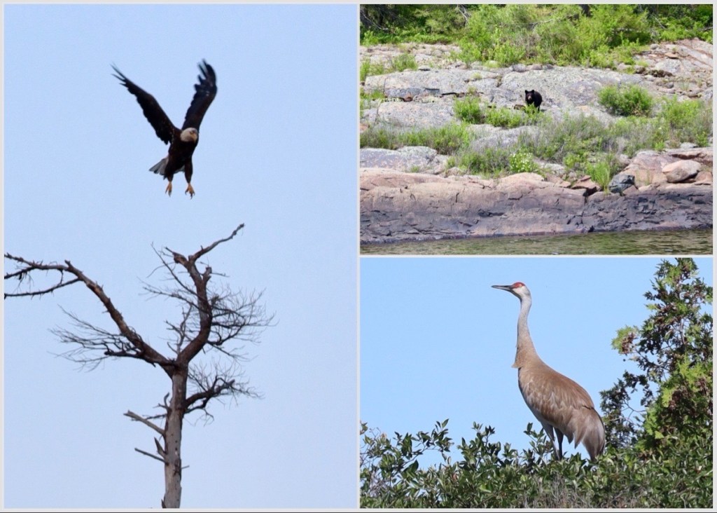
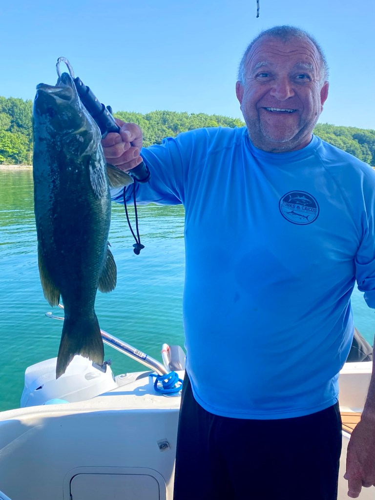
This area is great for fishing – walleye and bass, and wildlife encounters – sandhill cranes, bear, deer and eagles were just some of what we saw during our visit. And it was with this group we happily celebrated our Canada Day – it was a festive but quiet celebration – exactly how we like it!
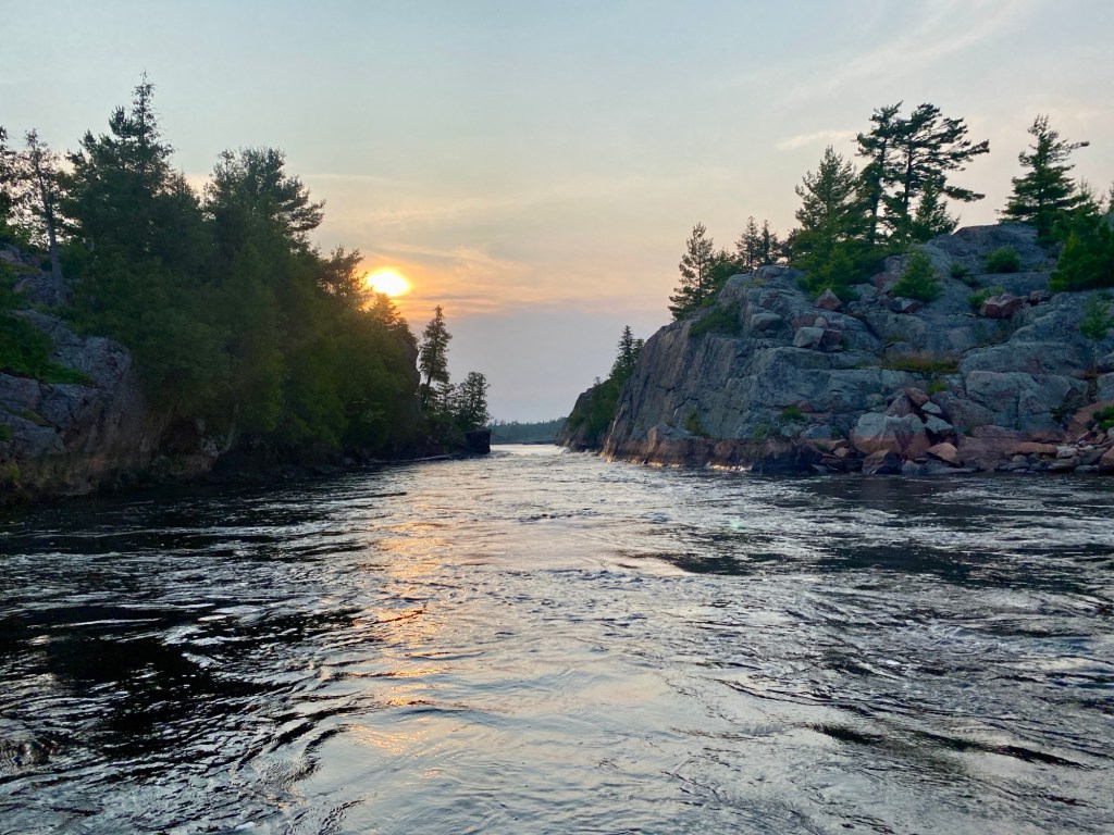
After 4 incredible nights at the Bad we sadly say goodbye and head west, the white quartz of the La Cloche mountains coming into view as we head towards Killarney. We decide to take the slower more scenic route through Beaverstone Bay and Collin’s Inlet. One note of caution is on the depth through the entrance, always a concern for sailors but this year we know sailboats have gone through without a problem, however next year may be a different story with water levels on a downward trend.
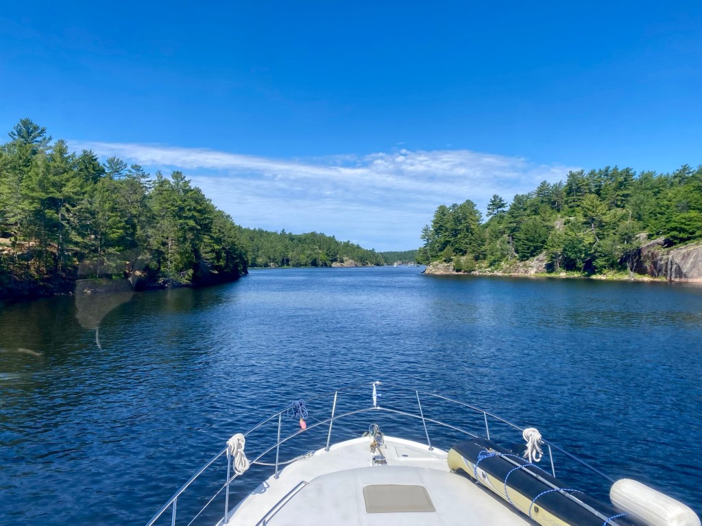
There are a few anchorages both within Beaverstone Bay and throughout the inlet, most shown on the charts.
One very interesting side trip is to dinghy up the Beaverstone River! This is a challenging remote wilderness trip and you should take a pike pole, good knife, and drinking water. It can be difficult to locate the entrance plus the water is almost black making all underwater obstacles invisible. You will have to dodge fallen trees and other foliage, plus there is no cell service. However it is quite a thrilling trip with lots of twists and turns, at times it feels like you’re Indiana Jones on a remote jungle river with eyes in the bush watching you! Eventually you will come to a very spooky looking cabin perched high in the trees with a zipline crossing the river. We went on a little further than that, almost 2 km up the river!
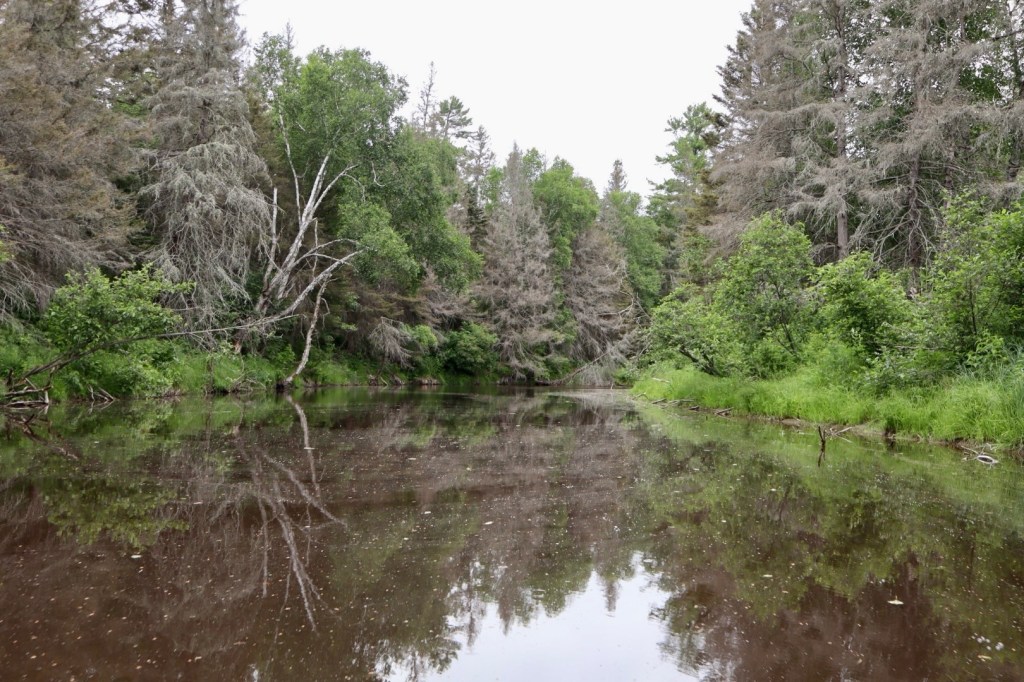
If you have the time, drop the hook in Beaverstone Bay and don’t miss this fun adventure!
Killarney Bound!
Continuing west we exit Collins Inlet and soon see the lighthouse marking the entrance to Killarney channel. It’s always fun cruising through the village – lots of action, everyone waves – it’s a happy place! I always think back to when I was a kid passing through with my parents 50 years ago and love that not much has changed in all that time.
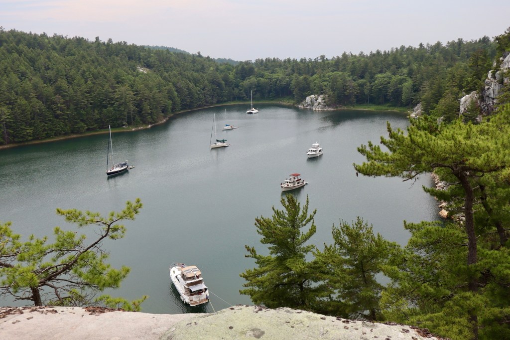
Having stayed at Killarney Mountain lodge last year, we decide to continue on to Covered Portage Cove, located on the northwestern edge of Georgian Bay and within Killarney Provincial Park.
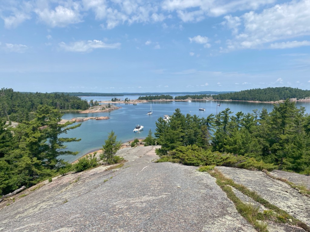
The beauty of Covered Portage is it’s a quick dingy ride into Killarney, saving mooring fees; the ugly is it’s a quick dinghy ride into Killarney which makes it’s one of the most popular anchorages on the North Channel! As we enter there is a boat just ahead of us, two coming up behind, all of us trying to find our spots within this fairly busy anchorage – kind of like parking at the mall on a Saturday!
Once anchored and stern tied to shore, we take advantage of the great weather and dinghy into Killarney for lunch and supplies. Upon our return we decide to work off our lunch by hiking to the top of the cliff that surrounds the cove. The climb through the forest has us working up a good sweat but once at the top we are rewarded with beautiful views of the cove and our boat!
The trail head is at the NW end of the cove (you may see other dinghy’s shored up there), be sure to take decent hiking shoes or runners, bug spray and water.
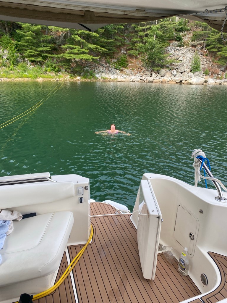
Back aboard Pearl, we waste no time swapping hiking clothes for swimsuits and jumping in. The cool water feels like heaven!
The next morning is grey with strong winds in the forecast. We plan to stay another night but already suspect we didn’t set the anchor as well as we should have. That suspicion proves correct when a big storm blows in that afternoon. We can feel the boat creeping closer to shore, and two other boats clearly have the same problem—they start their engines and try to reset. Rather than try to re‑anchor in the crowded cove with wind howling and rain pouring down, we choose to dinghy out and drop a secondary anchor. Thankfully it grabs well, but it’s still a fairly sleepless night for us as the winds howl and the rain pounds our deck.
Badgeley Quarry to Manitoulin Island
Eventually it passes, we get some sleep and awake to a beautiful calm sunny day! Time to depart Covered Portage and as we do, I get a good picture of the Indian head on the rock.
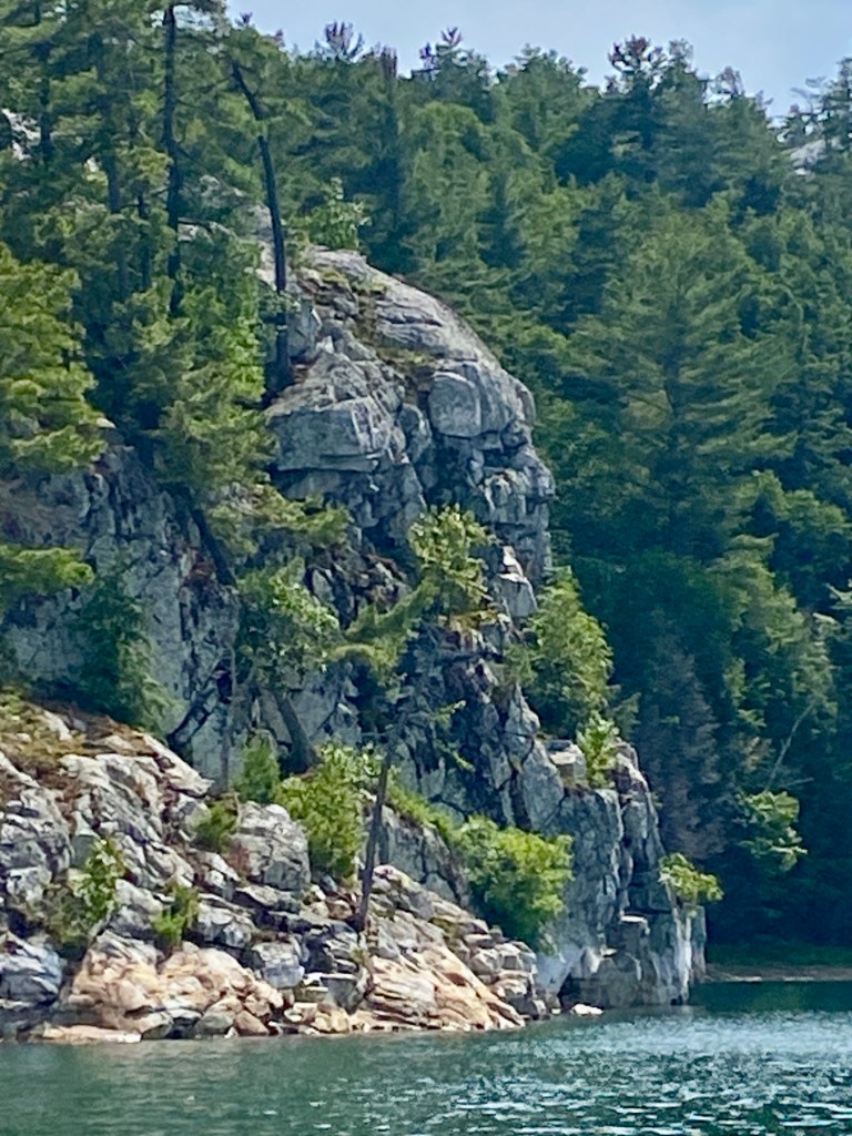
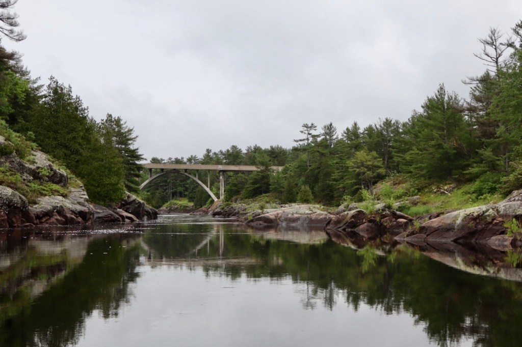
We head west along the Lansdowne Channel, where we pass the Badgeley Island silica quarry, then enter the North Channel through the century old Little Current swing bridge. This bridge has had its share of trouble including opening issues and in 2025, the Ontario government finally committed to replacing it. Construction is slated to begin in 2026 and is not expected to affect mariners.
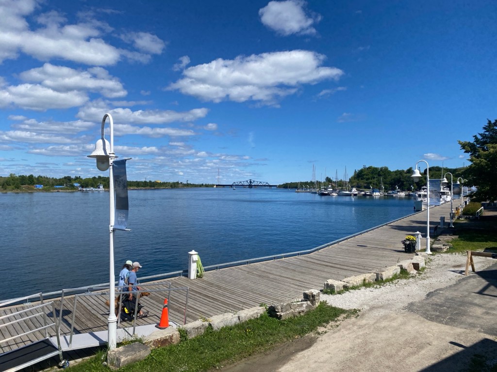
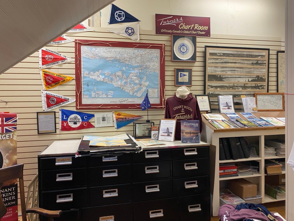
Little Current is the gateway to the North Channel and much of its fascinating history is on display at “Turners of Little Current” – a mini department store now in business over 140 years. They have a 2nd floor filled with information about the town’s founders and history, local artwork and of course the Evinrude family who had a cottage at The Pool within Baie Finn. They also have a well stocked chart room should you need some updates. If you have time, take in one of Roy Eaton’s morning broadcasts in person, always fun and a great way to meet other boaters!
Exploring the Benjamin’s
After one night we depart and head west towards the Benjamin’s, looking forward to getting back out at anchor. The day is warm but a little grey, we hope any rain will hold off until after we arrive.
We are now cruising the North Channel, with Manitoulin Island to our south and an abundance of island anchorages to choose from to the north. Our destination is the north harbour at the Benjamin Islands, a fairly popular anchorage for boaters and our second time visiting.
We manage to get anchored just before a light rain begins. We are excited to be back and not even the rain can mask the beauty of the Benjamin’s with their rolling pink granite hills topped with windswept pines! We spend our days enjoying the cool clear water, a little hiking and kayaking, looking for blueberries, and lots of dinghy exploring. During our visit we have some severe thunderstorms roll through with an east wind for a bit and that causes some uncomfortable current and swells through the anchorage but it’s short lasted and soon the sun reappears.
That evening we receive a forecast calling for high heat and strong winds from the southwest. Checking our charts for a well protected anchorage we make a decision to move over to Amedroz Island in the morning – we have never been before but have heard there is a sand beach. After our final night at Benjamin’s, we pull up anchor and make our move enjoying a nice leisurely cruise over to Amedroz , just east of the Benjamin’s.
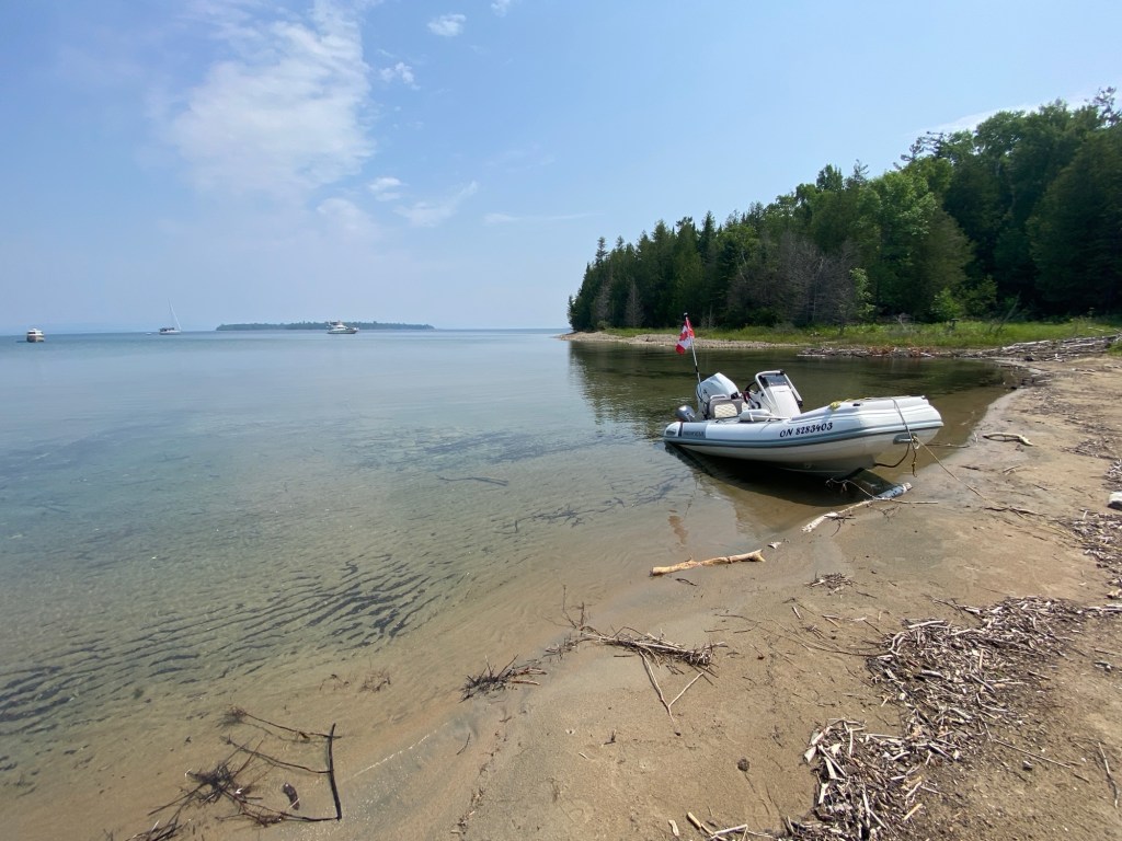
Although most of Amedroz’s eastern shore is rock ledge, we manage to find the sandy beach nook and anchor just offshore. We drop the dinghy and head to the beach which is quite interesting – there is a crude camp with a fire pit and rusted ax but no sign of recent human activity. The water is incredibly clear here, but quite cold – 66F was the highest we saw during our visit.
Island Time!
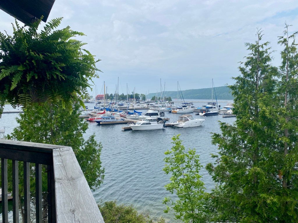
We stay a few nights but then receive a severe weather warning (which seems to be the norm this summer!). We decide it’s probably best to be in a marina and so take this opportunity to visit Gore Bay, calling to reserve a transient slip. This turns out to be a pretty good decision as the next morning as we cruise towards the marina, vhf channel 68 is filled with mariners requesting slips for the night. By 3 pm that day the marina is packed and refusing late comers, the wind just beginning to increase but still a beautiful afternoon – hard to believe bad weather is on the way! We decide to take advantage of the sunshine and get some groceries plus do laundry. Dinner was at Purvis fish and chips for some delicious fresh pickerel!
Overnight we can feel the winds and current increase, Pearl starts tugging on her lines so we go out and make some adjustments. By morning we had a cool northwest wind bearing down on us, grey skies and whitecaps outside the marina.
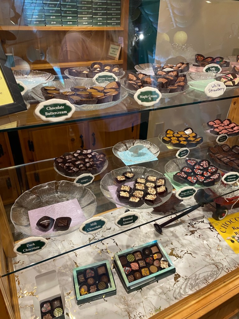
Not wanting to sit on the boat we set off exploring, determined to take advantage of our time here and explore a little of Manitoulin Island, beginning with a visit to Kagawong – the next town to the east.
It’s no wonder Kagawong has been described as one of Ontario’s prettiest villages! There is a municipal marina, museum filled with local history, a chocolate factory (heavenly😋) and the picturesque Bridal Veil Falls!
When we arrive back at Gore Bay, armed with boxes of chocolates and worn out from our exploring, the sun finally makes an appearance! A good sign that tomorrow we will be off the dock!
We spend the afternoon touring the Purvis Marine Museum which was very cool, and enjoy a final dinner at Purvis fish and chips before getting to bed early.
We awake to a beautiful morning excited to get back to anchor but it looks like every other boater has the same idea! There is a line up for fuel and pump out, but as we only need pump out they let us in after just a short wait and then we are off!
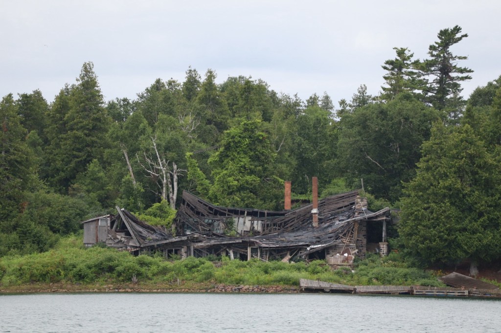
Our destination today is not far – Clapperton Island Harbour where we anchor off of Harbour Island. It’s hard to believe that today, where only ruins exist, there was once a thriving luxury yacht club and fishing retreat hosting wealthy clientele from all over North America. The museum in Kagawong contains some of the history of Harbour Island. We spend one night before continuing east the next morning.
Our final stop on Manitoulin before heading back to Georgian Bay is Manitowaning, located south of Heywood Island. As we approach the municipal marina we see some docks but ones only suitable for smaller cottage sized boats, however there is a rough pier we can fit onto. We call the marina office by vhf and cell but no answer so decide to dock on our own as the pier looks fairly sturdy. Eventually a young dock hand comes to meet us with paperwork and asks for a copy of our insurance if we wish to spend the night. I found that a bit odd – maybe that’s becoming more of the norm however it’s the first time I’ve been asked and considering the state of their facilities, I probably should have asked for a copy of theirs!
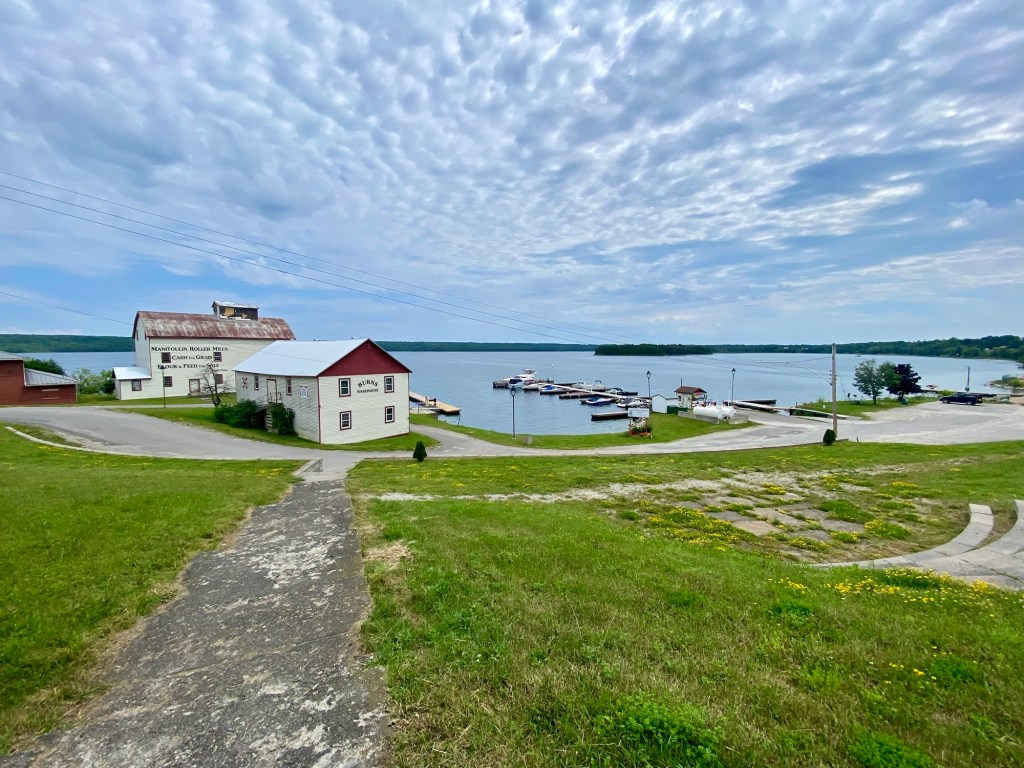
Manitowaning is a quiet village with a small grocery and liquor store within walking distance of the marina. The docking facilities are very primitive and mostly for boats under 30’ in length. We didn’t mind docking alongside the pier but we quickly realized an otter family had taken up residence within the beams and their lovely odour was a bit overwhelming at times. After one night we decided it was time to depart the North Channel and get back to our home waters of Georgian Bay.
It’s a rainy misty morning when we awake, there is a soft fog which has enveloped the entire eastern end of Manitoulin and follows us out as far as Lonely Island when we finally see rays of sunshine poke through.
We Save the Best for Last!
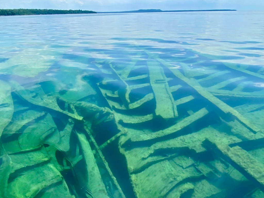
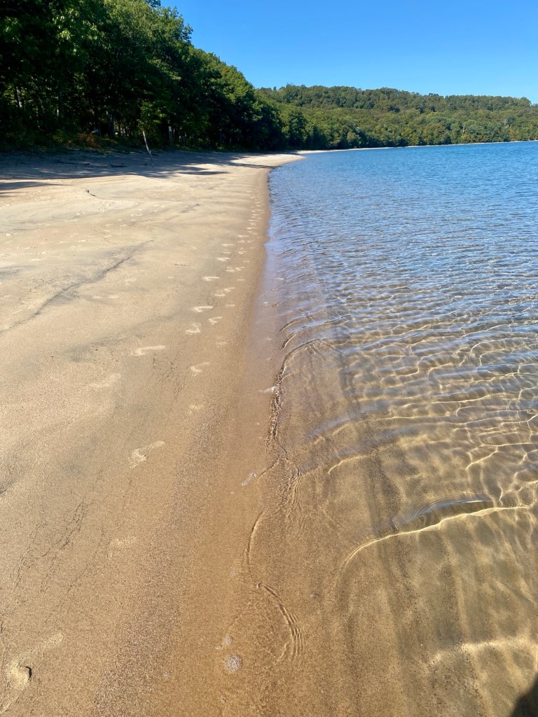
We are now setting course for our very final stop of this voyage and when we started out almost 6 weeks ago, we agreed to leave our decision on the final stop until the morning of, and that it would be on Georgian Bay. Well, with the forecast calling for a few very hot humid days ahead, the decision is easy! We decide to celebrate our successful voyage by spending a few nights at one of our favorite anchorages on southern Georgian Bay – Little Sand Bay at Christian Island.
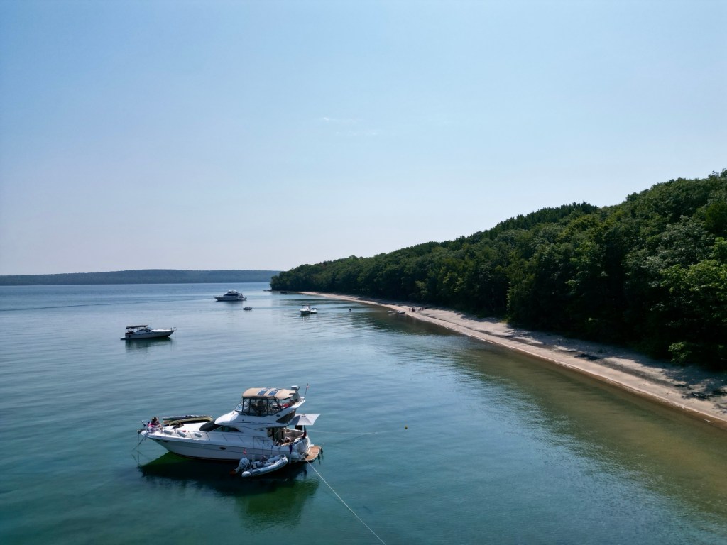
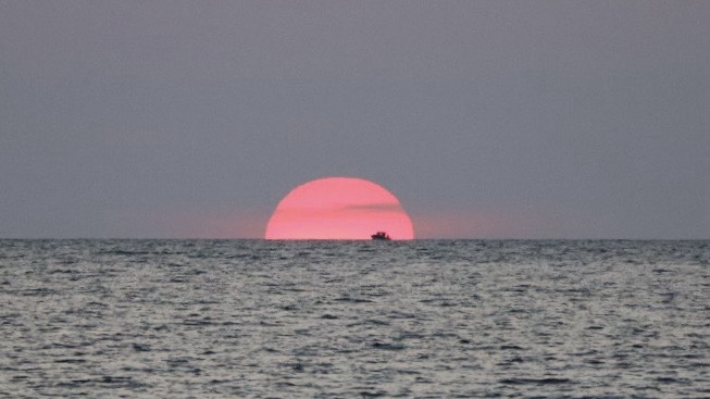
From Lonely Island, it takes us 4 hours of traveling but well worth it! At Christian we take walks on the beautiful soft sand beach, swim in the crystal clear waters, visit one of the local shipwrecks, get in some fishing, and dinghy out for stunning sunsets – it truly feels like the Caribbean of the north!
For further details on visiting this area click link:
https://georgianbaybeauties.org/2021/10/03/caribbean-of-the-north/
Reflections on the Journey
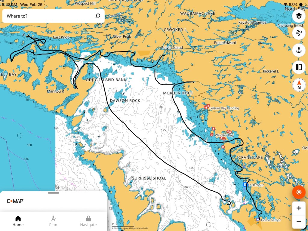
Six weeks, twelve stops, 415 nautical miles not counting our dinghy trips, and one magical adventure! While at Christian we have a post-cruise review of what we loved and what we wished we’d done different.
We experienced a few challenges along the way, endured some scary thunderstorms, met some wonderful people, learned a lot about ourselves, and our relationship! Living in close quarters while constantly on the move and adapting to ever changing weather and sea conditions can be challenging! However we found our rhythm, solved all problems on our own, and are already planning our 2026 trip.
So to sum it up, there’s nothing we will do different next year except hopefully go further, stay longer and see more of the incredible Great Lakes!
Hope you enjoyed my cruising log story! Be sure to follow my Facebook page and website if you are planning to cruise beautiful Georgian Bay any time soon!
Website: www.georgianbaybeauties.org

thx for taking us along!! We will be up on the Bay and NC this August.. we will all soon be back on our boats.
LikeLiked by 1 person